Staff Reporter
The Zimbabwe National Geospatial and Space Agency (ZINGSA), a Government-owned entity established under the Research Act [Chapter 10:20], is rapidly transforming the nation’s approach to urban planning, agricultural management, and environmental protection through cutting-edge research in geospatial sciences and earth observation.
Launched by the President in 2018 as a strategic initiative to tackle socio-economic challenges using space technologies, ZINGSA has since become a pivotal player in addressing issues ranging from illegal settlements to disaster management.
In an exclusive interview with Harare Post yesterday, the agency’s Director, Painos Gweme, outlined the broad scope of ZINGSA’s work.
“We conduct specialised research and development on projects involving crop yield estimation, remote sensing, and environmental monitoring. Our systems allow us to map the entire country and even trace current developments, from veld fires to land degradation,” said Gweme.
The Director also emphasised that ZINGSA’s technology is not limited to academic or theoretical applications.
“Our satellite data provides essential insights that support agro-ecological mapping, which is used nationwide. For example, our agro-ecological map and fertiliser-soil matching projects are already assisting farmers to determine the right inputs for specific soils,” he added.
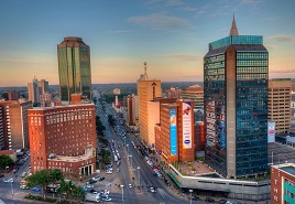
In addition to supporting the agricultural sector, ZINGSA is actively collaborating with the Ministry of Local Government and Public Works’ Department of Spatial Planning.
The partnership focuses on identifying dysfunctional and illegal settlements in targeted areas, enabling authorities to make informed decisions that promote orderly urban development.
“By leveraging our geospatial intelligence, we help the Government pinpoint areas where unregulated settlements are causing challenges in service delivery and environmental sustainability,” Gweme noted.
ZINGSA’s remit also extends to disaster management and environmental assessment.
Its capabilities in space weather monitoring are used to detect and analyse phenomena that could impact Zimbabwe’s technological infrastructure, allowing for proactive risk mitigation measures.
Moreover, the agency is involved in geo-technological surveys to assess environmental degradation, underscoring its commitment to preserving Zimbabwe’s natural resources.
Human capital development remains a priority at ZINGSA. The agency has invested in international training, sending engineers abroad to acquire specialised skills that can be applied domestically.
“We are practical people. Our efforts in training and capacity building ensure that the latest knowledge in space and geospatial technology is brought back to develop our country,” added Gweme.
With projects ranging from the revision of Zimbabwe’s Agro-Ecological Zones to the development of the Zimbabwe Wetlands Master Plan, ZINGSA is at the forefront of harnessing space technology for tangible economic and social benefits.
The agency’s work not only supports strategic planning and environmental conservation but also drives innovation in agriculture, disaster response, and urban management, laying the foundation for a more resilient and technologically advanced Zimbabwe.